Montague County gets weather. Not in the understated sense that all places get weather — in the specific sense that north-central Texas, sitting between the Gulf moisture plume to the south, the dry Continental air mass to the west, and the jet-stream corridor overhead, produces some of the most energetic severe weather in the United States. Spring — roughly March through June — is the primary season, though significant severe weather events have occurred in every month.
Why North Texas Gets Severe Weather
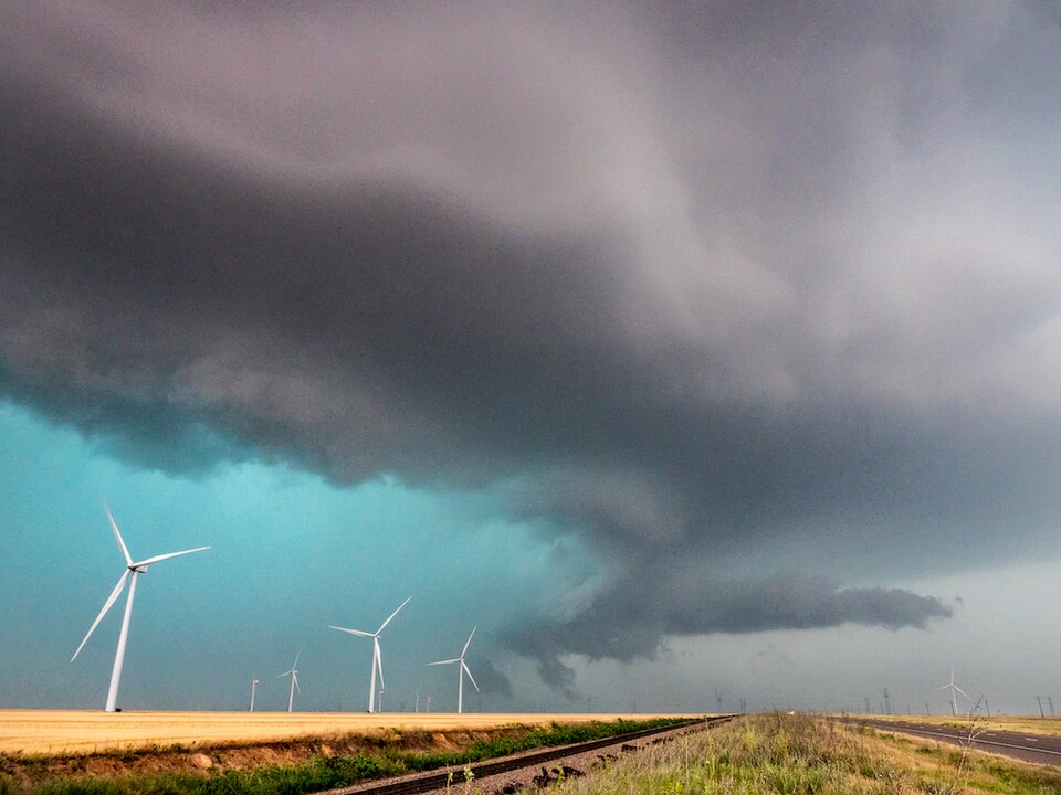
The mechanism is consistent: Gulf of Mexico moisture flows north into Texas during spring, warm and unstable. Dry, cool continental air moves in from the west and northwest. When these air masses collide along the dryline — a boundary that frequently sets up over the Rolling Plains west of Montague County and then moves east during the afternoon — the result is explosive thunderstorm development.
The specific combination that produces tornadoes and large hail requires a rotating column of rising air — the supercell thunderstorm — which forms when wind speed and direction change with altitude (wind shear) in the right way. The southern Plains, and north Texas specifically, are one of the most consistent producers of supercell thunderstorms on Earth. The tornado season that draws storm chasers to the region every April and May is the visible result of this geography.
Montague County’s Severe Weather History
The county sits in documented tornado country. The neighboring 1906 Bellevue tornado — which tracked from Clay County into Stoneburg in Montague County — killed 17 people and destroyed a community. A severe season in 1905 damaged the Montague courthouse and killed dozens across the region. Multiple other tornado events have struck the county across recorded history.
For the specific historical tornado events and their impacts on MoCo communities, see Notable Tornadoes in Montague County.
The Spring Season Pattern
March–April: The dryline begins setting up and moving east more frequently. Supercell activity possible from early March. Tornado risk increases through April as Gulf moisture deepens. Large hail — baseball-sized or larger from significant supercells — is the most frequent damaging event even without tornadoes.
May: Peak tornado season for north Texas. Warm, deep moisture; frequent dryline cycles; strong jet stream still overhead. May is statistically the most active month for significant tornadoes in the region.
June: Activity continues but begins to shift northward and westward as the jet stream lifts. Still a significant severe weather month. Heat begins building, and the moisture regime starts shifting toward the dry-heat pattern of summer.
Living with Spring Weather
Storm shelters — underground cellars in the traditional construction, or above-ground safe rooms in more modern homes — are part of the built environment in MoCo. The 1906 Bellevue–Stoneburg tornado (Bellevue in neighboring Clay County) that killed 17 also documented a cellar that sheltered 21 people through the storm: community memory has always included knowing where shelter is.
NOAA Weather Radio, emergency management alerts, and county emergency services all provide warning infrastructure. Outdoor warning sirens are present in incorporated communities. Rural areas depend on weather radio, phone alerts, and the kind of sky-watching that north Texas residents develop intuitively from living in the region.
Related: Notable Tornadoes | Climate and Weather | Drought Cycles